![]()
Visitor:
![]()
![]()
![]()
Below are trail descriptions accessible from CA-4 arranged in west to east order.
Located between Arnold and Camp Connell on Highway 4, is Boards Crossing Road which winds down to the Stanislaus River and the Sour Grass recreation area. The Sour Grass 4WD trail has been adopted by the Bounty Runner 4X4 Club from Fremont, CA. The trail is approx. 2.5 miles long and rates at about 2 on a 1-4 scale. A stock T-100 made it up with a little guiding after kissing a few rocks on cross members underneath and full-sized pickups with campers have reportedly made it up. It consists of a narrow dirt road along the river bottom, with a few rocky ledges, several creek crossings and some secluded camping sites.
This trail is reached via an unnamed road about 8 miles up from Boards Crossing Road. You are quickly on a dirt road into a logged area. The trail heads off to the left at a clear cut area and narrows and drops into some tight turns among the trees. Then the trail becomes steeper and rocky with several ledges before you hit a stream crossing and the infamous tree root. Once past this obstacle, its smooth sailing to the Stanislaus River and the trail's end. The area along the river is private property. Total distance from the highway to the river is 8 miles, with the last 3 being difficult. It takes about 2 hours to make the trip one-way.
Located on the north side of Hwy. 4, just west of Bear Valley.
This is a fun trail that connects Utica Reservoir and Lake Alpine. Utica Reservoir is accessed from Spicer Road about 10 miles up from the Ramsey turnoff. Take the left turn to Utica and follow the gravel road to the trailhead. The first mini-obstacle is a climb up a rocky ledge. After a brief flat area, you'll encounter a rocky drop down a taller ledge. Beyond that you'll cross and wander along the creek until encountering the slick rock hill. A step at the bottom of the slab will cause problems with open diffs. The final obstacle is an off-camber sluice. Total time to transverse the trail is under 2 hours.
There is a 4WD trail that leads south from the Pacific Valley campground (at the base of Pacific Crest Grade). From the DeLorme maps, it appears this trail continues on for several miles up the valley.
This trail connects Hermit Valley along CA-4 with Blue Lakes on CA-88. The southern trailhead is at the east end of the Hermit Valley campground, located at the base of Ebbetts Pass. The trail's most difficult obstacle is right at the beginning of the trail, a rocky outcropping above a campsite. The narrow, rocky trail climbs quickly from 7000' up to about 7800' before leveling out. You'll cross Deer Creek a few times before coming to a wide sandy meadow with excellent camping spots. A few miles farther and you'll reach the northern end of the trail where the main road from Blue Lakes forks off towards Twin Lakes. Distance from CA-4 to this point is about 8 miles and travel time is approx. 2 hours.
Note: Deer Valley trail is in search of a 4WD club to adopt it. If your club is looking for a trail, contact a ranger.
![]()
A group of 5 trucks met in Angel's Camp for a snow run down to the Sour Grass Trail. In the group were:
Both Terry and Craig are Bounty Runner club members. Upon reaching the end of the plowed road, we aired down and locked up. I ran 14-15 PSI, while the folks with wider tires went to around 10-12. The road had about 3' of spring-like corn snow with a few inches of newer snow on top. The road was unplowed, but had some evidence of vehicle traffic since the previous weekend's snowfall. The elevation is about 5000' at this point.
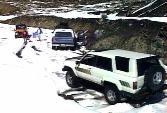 Terry
led off, followed by Craig, then me, Kevin and Rob took up the
tailgunner spot. Kevin ran into trouble almost right away. He was used
to more compact snow and between the wider track of the D90 and the
lack of directional control on the Swampers, he twice ran off the
beaten track. The aggressive paddle tread would instantly dig down in
the soft snow, leaving the D90 high centered on the axle skid plates.
Rob pulled him backwards one time then had to execute a pass in the
unpacked snow to get around and pull him out from the front. The rest
of the trip down to the river crossing was less eventful. It was tricky
driving, though, as soon as you relaxed a bit, you'd find yourself off
in the soft stuff. The wider vehicles had the hardest time keeping on
track.
 At
the river (3900' elevation), we saw the remains of last year's massive
mud slide that took out the old bridge. However, it appears the El
Niño storms of this winter caused some undercutting of bridge
support on the far side. The bridge decking has been removed part way
and the bridge is closed to traffic. As a result, we decided to stop
for a lunch break in the sun and then head back out the way we came in.
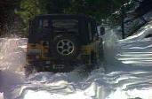 The
snow was a lot softer and wetter due to the near 70 degree
temperatures. Kevin was having trouble with the Swampers digging in
anytime the slope got a bit steeper. After yanking him out a few times,
we finally got up to firmer snow where the D90 did better.
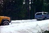 In
fact, here Kevin got a chance to pull out Craig's Bronco about halfway
up the hill.
As the snow was thinner at the bottom of the hill, I tried staying in 2WD for the return trip, I only had to engage 4WD about 6 times on the 4 mile climb out of the valley. Those skinny BFG M/Ts were very impressive in these conditions. The tread blocks on the 9.50 M/Ts are rotated more in-line with the direction of rotation as compared to the wider 12.50s. The tread blocks are basically the same size between the two tires, but since the actual tread width is about 50% more on the 12.50 tire, the center blocks are oriented across the tread surface rather than along it as in the 9.50 tire. This must help with directional control, perhaps at the expense of ultimate traction straight forward. I found the 9.50 tire didn't dig in as quickly as the 12.50s did. I had time to get out of the throttle before digging in too deep, so I could back out under my own power. I think Rob and I had the only two rigs that didn't require tow straps or shovels on the trip. This was my first real "snow run" and I really enjoyed the trip.
![]()
A group of 5 trucks met in Angel's Camp for a snow run down to the Sour Grass Trail. In the group were:
 We
headed up Hwy. 4 to the Boards Crossing Road and a heavy snow shower,
hit what appeared to be the snow line, aired down, locked up and after
1/4 mile of somewhat tricky snow were back on wet pavement. Snow turned
to rain as we drove down to the new bridge to find it still closed.
 So
we headed back up the hill to the turn-off to the old bridge. The exit
from the downhill direction is a tight 180 degree turn. Down a muddy
narrow road we got the the old single lane bridge, then climbed steeply
up the hill to meet the paved road across the river.
 Finally,
at the opposite side of the new bridge, the Sour Grass trail proper
begins right next to the restroom. Within a few hundred yards, you hit
a tricky rock ledge with several steps about 100 feet long. To the left
you can S-turn around the steps and boulders, to the right is a nice
crack to straddle. As soon as you crest this ledge is another shorter
rockier ledge. Here Terry follows Mike around the left side of the
ledge. You can also straddle the crack to the right.
Several small stream crossings, some narrow dark sections through the trees finally led to the main creek crossing about 1 mile into the trail. The spring runoff was in full flow, there were a few 3-4' deep holes on one side of the stream. In the snow and cold, nobody felt like wading across to test the depth and Kevin's clutch was acting up, so we turned around and headed out to try and find some snow to drive in. We stopped to air up Kevin's front Boggers that were nearly flat after loosing air over the rocks.
Back to Hwy. 4, R-1 chain control was in effect. Kevin and Mike headed back home, while the rest of us went up 4. Past Camp Connell, R-2 chain control was up and we saw several cars turning back. We plowed ahead and tried a few Forest Service roads. Unfortunately, immense piles of snow had been pushed onto the roads by the snow plow crews.
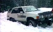 Finally
we found a road lower down that looked promising. Up a short hill, with
a deep muddy rut, Terry ran across two J**ps stuck in the snow. Once
they were clear, first Terry then I tried to get up on top of the
crusty layer on the 3' snow pack. I got about 1 car length farther than
the rest but was buried to the frame in a granular snow that set up
hard around everything. Some persistent shovel work and finally a tug
from Terry popped me out. We called it a day and headed home.
![]()
Well, finally a chance to run these trails without snow (or so we thought). Only problem was my truck was in the shop (the start of a 5-1/2 week ordeal to get it back, but that's another story). So, I managed to bum a ride in Terry's extra cab along with his co-worker who rode in the rear jump seat. Anyway, the Get-N-Off 4x4 club was having a run up Sour Grass and Ramsey trails over the weekend. Terry led a small group going up for a day run Sunday. As you head east on Hwy. 4, the Ramsey Trail is a gravel Forest Service road to the right just as you can see the Cottage Springs ski area sign.
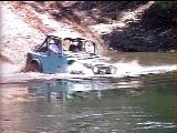 We
met up with the main group camped at the Stanislaus River at the bottom
of Ramsey Trail. On the way down, we followed a couple of other Jeeps
and when we got to the runoff-swollen river, we were amazed to see one
of these Jeeps on the other side! He didn't make it back (under his own
power at least). With his winch cable and Terry's combined, we were
able to hook up in mid-river and winch him across (his battery was
dead). After a lot of work, they finally got the water out and his
engine running.
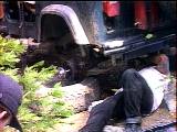 One
of the Jeeps in the club broke a rear axle (Dana-35) and was able to
contact one of the rigs coming up Sunday, so we brought up a spare
axle. The still-dripping-wet Jeep driver lent a hand trying to get the
remnants of the old axle out so the new one could be installed.
Deciding there was enough (too many actually) hands for the repair, a few of us headed up Hwy. 4 to Spicer road. At the snow parking lot, the road was still covered w/ snow. We took off down the road towards the reservoir. It was tough going (downhill!) in the soft spring snow. After an hour or so, we decided to turn around and head out. Terry's 1/2 worn M/Ts were having some trouble getting uphill. Finally we dropped the air down to about 10 psi and the going was much easier. Back on the main road, we aired up at Bear Valley before heading down for a good dinner in Angel's Camp.
![]()
I joined Terry (trip leader - '89 Toyota Extra Cab, 33" locked F/R), Dan ('93 Tacoma, 33" locked R), and Kevin ('94 Defender 90, 31" locked F/R) to tackle 4 trails in two days. We met up at the BK Plaza in Angel's Camp Friday evening on our way to the Sour Grass Trail and camp for the night. Now that the new bridge has been repaired, access to the trail head is fast. The actual Sour Grass campground was torn up for repairs, so we locked up and headed up the trail a mile to the first flat area. Dan's ADD was acting up and he had some trouble with the climb in 2WD.
The next morning, after some inspection, it was determined that simply swapping the vacuum leads to the ADD would engage 4WD, so we were off for Ramsey. We headed down the trail, where we met several groups of Jeeps on the trail. They had the private camping area along the river reserved. We stopped at the bottom of the trail for lunch and to play in the river. Then, it was back up the hill to the highway then on to Spicer road.
We reached the Slick Road trailhead at about 3:30 PM and wanted to get through so that Dan and kevin could head home. At the first obstacle, a stock-looking Toyota p/u and Jeep Cherokee slammed and banged their way up the ledge as local campers watched. Deciding that was enough challenge, they pulled to the side and let our group through. At the second obstacle, there was a large group gathered. We dropped down the notch one at a time, I ran in Marlin low range and made it down without touching the brakes or my rear bumper. Several of us decided to try going back up the rocks. Terry spun a bit where two slick rock steps caused both front and rear wheels to climb simultaneously. Kevin popped right up with his Boggers gripping the rock very well. My skinny tires lost grip on the double step and I kept slipping to the right causing my rear diff to hang up. Finally got far to the left and crawled up the rest of the ledge.
At the slabs, I watched the 3 rigs in front make the climb, then I tried it. As the rear wheels got to the step, the left front caught major air. I tried using the brakes to lock up the TrueTrac but could not make any progress. Finally, found a line far to the left that got me up and over the step. At the finally obstacle, I found the last part of the sluice was off-camber at about 25°. (Later that afternoon, at camp, I found a nice fresh scrape on my right front hub and that it was halfway between Lock and Free. Since the TrueTrac is limited slip, if one hub is unlocked, it can't transfer any torque, so I guess did most of Slick Rock Trail in 2WD - doh!)
After finding 4 full campgrounds, we finally found a vacant space at Pacific Valley campground, the last one before Hermit Valley. Luckily, there was a small stream next to it and the water pickup for my shower was soon in it. By morning the thermometer read 43° before the sun finally made it down the valley wall to our campsite. We broke camp and were at Hermit Valley by 10AM. The trailhead is at the far eastern end of the campground. We popped up the entrance obstacle with the local campers for an audience. On the trail were met several groups of mountain bikers as well as a nearly stock Toyota p/u coming the trail. After stopping at the last crossing of Deer Creek for a break, we met the local OHV ranger who mentioned he is looking for a club to adopt the trail.
I joined Terry (trip leader - '89 Toyota Extra Cab, 33" locked F/R), Kevin ('94 Defender 90, 31" locked F/R) and Bill and Hawk (stock '97 Jeep Cherokee, UpCountry suspension, rear L/S) to tackle the high trails before the snow closes them for the season.
 We
aired down at the beginning of Slick Rock trail at 11 AM. We reached
Lake Alpine without incident about 1 PM then headed up the road to the
start of the Deer Valley trail. The entrance obstacle grabbed a front
control arm on the Jeep and a short pull from Kevin's rear mounted
winch solved that problem.
 Recent
heavy rains seemed to have had an effect on the trail, more mud, some
places filled in others washed out more, especially dropping down from
the first ridge to the stream crossing, which seemed to take forever.
 This
was my first time driving with the 33x9.50 tires and my fender flares.
That extra 3 inches of body width makes a difference, I managed to snag
a protruding tree root on one narrow uphill section. I have been used
to using the passenger side tires to gauge my width.
The aspen trees were beginning to change color, traces of ice were present on the shaded stream crossings and even some fresh patches of snow at the 8000 foot level let us know winter is not far off. Gosh and this area still had snow banks remaining the first weekend in August! We reached Blue Lakes at about 6 PM and headed up 88 to the Kirkwood gas station to air up (not!). The compressor was on the blink, so my on-board air worked overtime filling up 4 sets of tires.
This winter's snow run drew a much biggr crowd than last year. Something like 15 rigs showed up in Angels Camp Saturday morning. Present were members of both the Gettin'Off and Bountry Runners 4WD clubs out of the Bay Area as well as the norther California Land Rover club (including a local resident in an awesome Defender 101) and a number of independents. Owig to the large goup size, folks split up into two main groups. Most of the Rover contingent headed up to tackle the Ramsey trail, while the rest ventured a bit higher to find some deeper snow. We managed to get to the Gettin'Off Adopt-A-Trail and most of us decided to try to bust through the snow berm and give it a try.
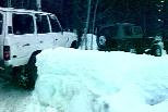 Scott
and George took turns and soon had a nice ramp up and over the berm
onto the untracked snow beyond. Here, Tom Boyd pilots Das Beast
up and over the berm. One Bronco suffered a punctured rear diff, so
stayed back to attend to the lack of gear oil. Several other rigs
headed back down to Ramsey to try their luck in the snow down lower.
It soon became apparent that the deep snow was going to make for some tough going. As I had the best surface area to weight ratio, I aired down my 33x15.50 Swampers to 2.5 psi and skirted around eveyone else to try and break trail. With the uphill slope and deep, soft snow it was tough going. I stopped and let more air out, dropping off the bottom of my digital air gauge (goes from 2.5 then 0.0), so I think I was running between 1 and 2 psi. For stretches, I could get up on top of the surface then would break through, especially when the road turned or the grade increased.
 Finally
we reached a stretch of soft snow that I just couldn't get on top of
and we stopped for lunch. In back, Leo was having trouble in the first
parts of the trail so turned around and left. Tom was also finding the
heavy Das Beast wallowing in the deep stuff and his 35" Mud
Terrains were digging deep ruts for Hogan in his Cherokee w/ stock
tires following him.
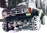 We
all managed to get turned around (although Tom thought he should test
his winch out just to make sure it worked). While waiting for Tom to
get turned around, I played around a bit with the crawler gears. I
found, to my amazement, that in my lowest gear, at idle, the truck
would just crawl right over the deepest snow. (Click here for a QuickTime video
clip of my Snow Crawler in action). Apparently, if you go slow
enough to let the snow pack under the tires, you can float up on top
with ease. I was halfway tempted to head back to the end of the trail
and push on.
After returning to Hwy. 4, we aired up a bit and headed back down the road to check out the Ramsey Trail. We got to the main turn-off area just in time to meet the Rovers to coming back up. After playing in the snow for about half an hour, Terry and Kevin showed up. They had just caught the Rover group at the last obstacle and had to spend some time winching Kevin's Defender 90 out of a high centered situation. Both groups made it all the way down to the river. After a bit more fun in the snow, we all headed back up the trail, aired up and headed home.
![]()

![]()