![]()
![]()
Visitor:
![]()
For the sixth year running, over the Martin Luther King holiday (Jan 16-18, 1999), a group of 8 4x4's, led by our fearless leader Terry Johnson, met near Ridgecrest, CA. early on the morning of January, 16, 1998 in preparation for two days of off-road adventure in Panamint and Death Valleys. The group consisted of:
Rumor has it that the 7th Annual Death Valley trip will take place on President's Weekend (Feb. 2000). Stay tuned to this Bat Channel for more details later this year.
![]()
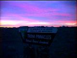 I
had arrived about midnight and decided to head out to the Trona
Pinnacles National Historical Landmark, about 25 minutes northeast of
Ridgecrest. I met up with Jack Geiger (his wife had to pass on the
trip). He was glad to see another person in the darkness. This time, I
got to see the pinnacles in the daylight and we ended up meeting the
rest of the group at the Trona Pinnacles turnoff on CA-178.
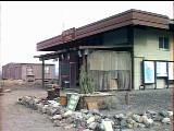 After
leaving the pavement and crossing the valley floor, here is the General
Store, now run by "Ballart Louie". We stocked up on
the essentials (maps, etc.), but everyone passed on the hot pink
Ballarat T-shirts. I had hoped to meet up with some Internet
acquaintences who were planning to run Goler Wash, but we apparently
missed each other. After airing down a but, we locked our hubs and
proceeded up towards Pleasant Canyon.
![]()
Our first trail was going to be the Pleasant Canyon - South Park Canyon loop. This is a 30 mile trip that starts at 1200' in elevation at Ballarat and rises to 7100' at the top of Pleasant Canyon. Apparently, in past years the trail was mild enough to get through the majority of the trail in 2WD.
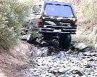 The
El Niño storms in Feb. '98 added a few loose spots and one minor
rock ledge obstacle which was fun. There was also an underground spring
which had water running down the trail in several spots. One of the
Bronco's had a tough time here. Some rock stacking and momentum was
needed to get him up. Open diffs, street tires, and not airing down
contributed to the difficulty.
A little further up the trail Chris Geiger had a problem with his right front brake caliper coming loose. A couple of stripped bolts were the culprit. We then stopped for a bit at Clair Camp. This was a mining town earlier this century. There is an old leaning water tower anchored to the side of a mountain to keep it from toppling over. There are some old rusted out buildings, vehicles, and machinery. There is also two huge blast furnaces which must have been fun to drag up to the site even if it was done in pieces. Near the top we went through a pine tree forest which is unusual in a desert environment.
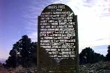 At
the top or Roger's Pass we stopped for lunch and had a peak of Death
Valley to the east and several mountain ranges to the west. At the
saddle is another mysterious sign posted by the Escape Trail
Conference, Trona Chapter. A magnificent 6' tall piece of 1/4"
steel plate, meticulously hand lettered with an oxy-acetylene torch!
Anyway, Chris cleaned up the bolts on his brake caliper and my tubes of JB
Weld Quik (4-minute set time) made quick work of Chris' strip brake
caliper bolt.
 After
lunch we crossed a steep ridge and went across a meadow, up over
another ridge and a second meadow on the way to South Park Canyon. It
was here in the second meadow we saw a herd of 5 wild burros.
 As
we entered the canyon we encountered some tall brush which sheltered
the ground where there was running water and ice! Luckily it had warmed
a bit and the ice was mostly melted off the trail. It looked to be
several inches thick and that it had covered the entire road surface in
days past.
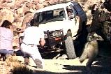
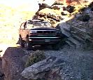
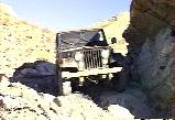 Shortly
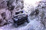
after we came upon the one obstacle in the canyon which apparently is
called Chicken Rock. It is high up on a narrow ledge and
requires a downward left turn around the wall with a slight lean toward
dooms day. There is chain link fence wire on the ground to help prevent
further erosion. It was plenty wide (another 4') even for the Broncos
but can be intimidating if you've never done it before.
 About
1/4 mile farther down is a narrow wooden bridge spanning a washed out
section of the road, it was rebuilt several years ago. At the bottom of
the ledge was a couple of cabins were being inhabited.
 A
little beyond the cabins we got a great view of Panamint Valley from
3000' - 4000'. We got back to Ballarat around 4:30 p.m. We were hoping
to get back early enough to go up to the base of the 1st waterfall in
Surprise Canyon. We will have to put it into next years itinerary. Here
is where we had to say goodbye to Chris Geiger and family. (His wife
had to work on Sunday.) The rest of us drove the approx. 90 miles to
Beatty, NV to spend the night.
We stopped in Panamint Springs to air up, but found no air station there, but plenty of 87 octane gas at $2/gallon! There appears to be a gas-powered compessor at Ballarat, in unknown condition. A better bet for gas/air is at Stovepipe Wells, over Towne Pass. Gas is in the $1.40 range and there is free air.
Sunday morning we split into two groups. The Broncos and CJ headed for Titus Canyon and the remaining Toyotas (Terry, Chris, Jack, John and I) went up to Chloride City. This is another old ghost town in the mountains east of the Death Valley floor. We came upon an old shack with a mine entrance directly behind it. Just to the left was a grave sight probably of some poor old miner. There were several mine shafts in the area.
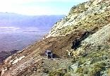
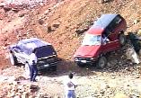 We tried one trail that looked to be heading to the cliff edge for
a view. It dead-ended at an old mine, just short of a spectacular view.
We managed to find room for 4 trucks to turn around and return to the
main road.
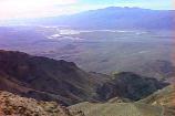
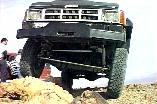 We
took a trail that brought us to the edge of the Chloride Cliffs. We
were at 5200' and had an amazing view of the entire valley floor below
us which is below sea level. I took this opportunity to check out the
front suspension travel and cross-over steering on a rock with a sheer
5000' drop inches beyond the front tire.
We then drove down to the valley floor and explored one of the canyons near Stovepipe Wells. Grotto Canyon is a short 2 miles from the paved road. Here we ate lunch and explored the canyon. Jack Geiger said his goodbyes here and got an early start home.
![]()
The rest of us crossed CA-190 and headed north of Stovepipe Wells into Cottonwood and Marble Canyons. After 10 miles of deep sand and rocky trail, we dropped into the Cottonwood wash and proceeded up into the canyon proper. There are lots of excellent camping sites in the dry wash. We took the right fork in the trail (after passing a spectacular narrow section of canyon - covered with somewhat recent looking petroglyphs) and headed 3 miles up Marble Canyon to the end of the road, a narrow squeeze blocked by a large boulder.
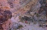 We
hiked a mile or so up the canyon (it goes on for about 10 miles).
 One
the way back down the canyon, John tried to sneak up on this wolf!
Stovepipe Wells has reasonably priced gas ($1.42 for 87 octane) and free air!
![]()
The background for this page is an image of Zabriske Point. I post-processed the image with Silicon Graphics Image Vision toolkit by running a Sobel Edge Detection filter on it, then rotated and cropped the image slightly to get the edges to tile properly.
![]()

![]()