Visitor:
![]()
Be sure to check the CalTrans Highway Information page before heading out.
![]()
Below are trail descriptions accessible from CA- arranged in west to east order.
The Niagara Rim area is about four hours east of the bay area. Just head toward Yosemite and then go up! Specifically, you head east on 580; 205 east; 15 north; 120 east; 108 to Strawberry ( 43 miles east of Sonora); look for Eagle Meadow Road just past mile marker 42; turn right and go about 300 yards to forest road 5N01; turn right and go about two miles; cross the bridge at Niagra Creek and the campground is on your left! Several trails in this are have been adopted by the Mud Sweat and Gears 4WD Club out of Sonora, CA.
The trail itself has a nice mix terrain; from open grassland to dense trees, volcanic rock and granite slickrock. Optional sections have been created to take you through some difficult terrain. On this trail, the bypasses are the difficult and the trail is moderate.
![]()
Leo Divinagracia ('90 4Runner) and I ('85 4Runner) met Terry Johnson ('89 Extra Cab) and his passenger Terry Bachle in the middle of a torrential downpour at the Pioneer Group Camp near Pinecrest, CA. at dusk on the 5th.
 By
morning the clouds had cleared somewhat and we packed up and reached
the Niagara Rim trailhead about 10AM to air down and lock up. We drove
out the gravel road to the far end of the trail.
 This
was my first time off-road with my new Swampers, so I opted for 10 PSI.
Looks like they conform to the terrain fairly well at that pressure.
 The
Niagara Rim trail pretty much follows the ridge line. Here it crests a
high point before a steep drop down into the meadow below.

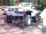 At
the next ridge, there are two routes, a rocky climb to the right of the
tree or you can squeeze between the tree and a rock ledge, which is the
line I am taking here.
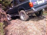 The
trail rounds a jagged lava flow. Here it drops about 6 feet straight
down then makes a 90° turn to the left. From either direction, you
would swear there is no trail ahead!
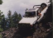
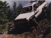 Here
I am dropping down over the volcanic outcrop. I found that the side
lugs on the Swampers grabbed the rock as I made the turn rather than
grazing off as I was used to my BFGs doing. This whipped the steering
wheel out of my hands and jammed the left front wheel into the fender.
I'll have to be more careful in the future to keep these tire off
things that I don't intend to climb!
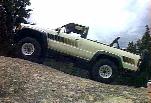 For
some unknown reason, 4-wheelers seem to park there trucks in crazy
positions when they stop for lunch. This is fine and well, until you go
to climb back in!
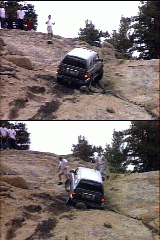 Along
the trail, the Forest Service has included little signed loops for
added difficulty. Here, the trail drops down below the slabs where he
had lunch then proceeds to climb right back up. The rain had washed mud
and loose sand onto the steep, off-camber granite making for a fun
climb. Terry made it to the top with little difficulty, then Leo had to
maneuver around a rock and got into a uneasy situation here. He had to
hook up and winch ahead a few feet to make it to the top. I followed up
in low-low-2nd gear and didn't slip a tire. Those Swampers rule!
After this point the trail is pretty easy. There is one additional "rock garden" on the way out. Terry drove up the lower part with ease. After getting back to the paved road about 2:30 PM, Leo and I aired up (the Swampers took about 20 minutes to go from 10-32 PSI). The Terry's went back to pack up the camp and everyone made it safely back home. Leo and I topped off gas tanks on cheap gas in Tracy on the way home.
![]()

![]()